GOLD PROSPECTING, GOLD PANNING
EASTERN GOLD
North Carolina Gold Prospecting
South Carolina Gold Prospecting
Georgia Gold Prospecting
Virginia Gold Prospecting
Alabama Gold Prospecting
CALIFORNIA GOLD (Statewide) (Mexican Border to Oregon state line)
Southern California Gold Prospecting Map 1 (eastern part-adjacent to AZ and NV-Death Valley to Yuma)
Southern California Gold Prospecting Map 2 (San Diego, Escondido, Santa Ana, Riverside, Palm Springs, Salton Sea)
Southern California Gold Prospecting Map 3 (Ventura, Los Angeles, Lancaster, San Bernardino, Big Bear Lake, Victorville, Barstow, Twentynine Palms)
Southern California Gold Prospecting Map 4 (Bakersfield, Randsburg east to Death Valley, Trona, Porterville, Visalia, Fresno)
Northern California Gold Prospecting Map 5 (Mother Lode- Yosemite, San Andreas, Columbia, Sacramento, Grass Valley, Lake Tahoe, Oroville, Magalia, Downieville)
Northern California Gold Prospecting Map 6 (N. edge of Map 5 to Oregon state line- Greenville, Susanville, Redding, Weaverville, Trinity Center, Yreka, Happy Camp, Crescent City)
REQUESTING GOLD
MAPS
GOLD LINKS
METAL DETECTING
RESOURCES
ANCIENT RIVERS OF
GOLD
Gold Prospecting, Panning, Mining, Treasure Hunting, Rockhounding, Recreation Maps
| LET OUR PROSPECTING AND PANNING |
| LEAD YOU TO |
| GOLD |
Maps for Gold Prospecting, Gold Panning, Gold Mining, Treasure Hunting, Metal Detecting, Rockhounding and other Outdoor Recreation activities.
BIG TEN'S GOLD PROSPECTING AND GOLD PANNING MAPS are used by thousands of families for outdoor recreation when vacationing, RVing, camping, picnicking, hiking, biking, backpacking, canoeing, fishing, hunting, gold panning, gold prospecting, rockhounding, treasure hunting and metal detecting. They are used by tourists, schools, scouts, libraries, geologists, military personnel, gold mining companies, gold museums and real estate interests in gold mining areas. Outdoors people are crazy about them. (These gold prospecting and panning maps make good gifts. We can send them directly to your friend with a note from us saying you are the donor.)
PROSPECTING AND PANNING IS FUN! HOW TO PAN! WHERE TO
FIND GOLD!
![]()
WESTERN U.S. GOLD MAPS
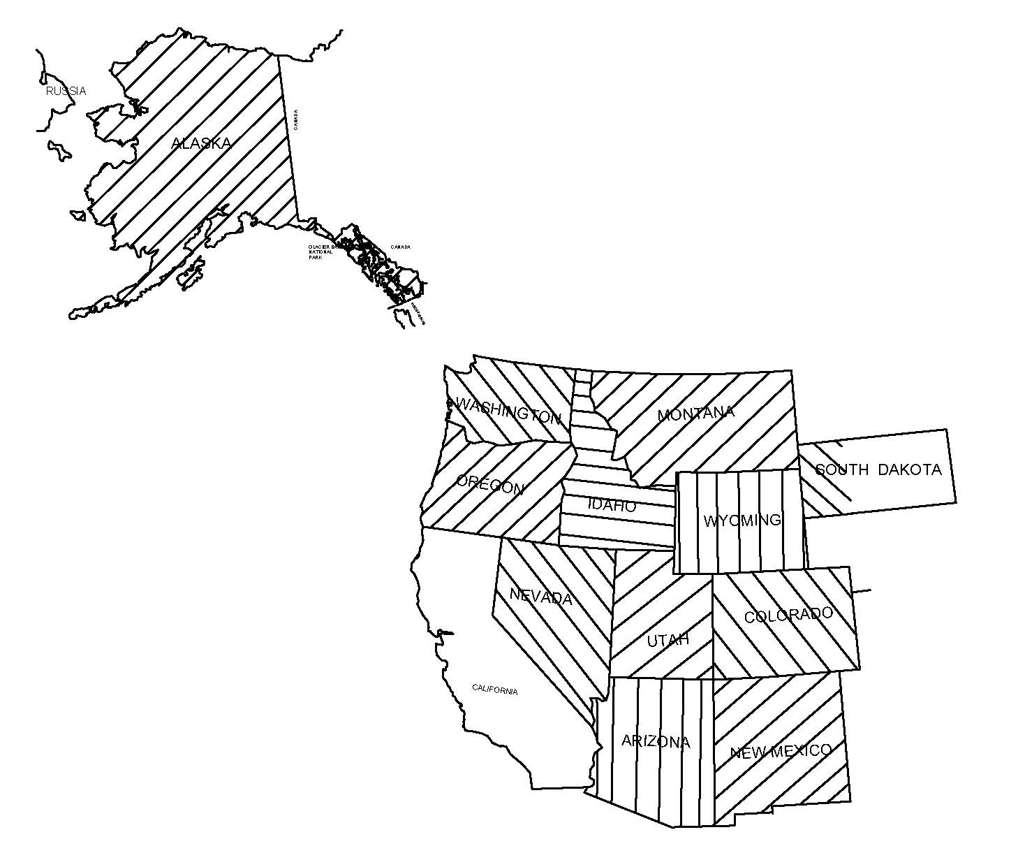
CLICK ON STATE TO FIND GOLD MAPS
These gold maps show where the gold was actually found from research of official USGS and local
records of Eastern and Western States. Ancient rivers are shown on the California Maps. Gold sites are plotted on
USGS Topographical maps. Western States gold maps include GPS coordinates and show ghost towns.
TO VIEW EASTERN U.S. GOLD MAPS + CALIFORNIA CONTINUE ON THIS PAGE.
DISCOVER WHY OUR GOLD PROSPECTING AND PANNING MAPS
| Are wanted | |
| Save months of research | |
| Save money and time | |
| Are right for you | |
| Are written about in: | |
| Changing Times, Readers Digest, Family Circle, Popular Mechanics, Modern Maturity, Trailer Life, Retirement Life, Travel Holiday, Gold Prospector, Lost Treasure, Rock and Gem, Western and Eastern Treasures, Southern Living, Los Angeles Times, San Jose Mercury News, New York Times, Philadelphia Inquirer, Atlanta Journal-Constitution, Charlotte Observer and other magazines and newspapers. |
GENERAL GOLD INFO
 A one ounce gold nugget will bring $2,000 to $4,000 on the collectors market.
Per a letter from the Department of Agriculture, no permit is needed for recreational
gold panning and gold prospecting in the general national forest areas, provided no machinery is used. Our gold
prospecting and panning maps show many national forests with gold
deposit sites.
The gold
prospecting and panning maps tell you how to pan for gold, where to look
for gold in a streambed and how to tell fool's gold from real gold.
You can quickly learn panning by following the gold panning instructions on your map. Some people like to pan for gold at public rights of way where bridges cross gold-bearing streams.
Treasure hunters use their metal detectors in gold prospecting and to
hunt for coins and jewelry at the rural churches and schools shown
on the gold prospecting and panning maps in the southeastern states.
You will enjoy prospecting and panning as the maps guide you to the
gold mining and prospecting
locations. A streak of gold mines and gold prospecting sites extends from near Montgomery,
Alabama to Washington D.C. The gold was
placed there when Africa overrode North America about 250 million years ago. North Carolina, South Carolina, Georgia, Virginia and Alabama
have many gold mines and gold prospecting sites. These states were our main
domestic source of gold for 45 years before the 1848 California gold discovery. In 1837, the US Government established gold coin mints in Georgia and North Carolina, rather than transport the raw gold
from the southern gold mines to the Philadelphia Mint. Prospecting
and panning information for each state will be found by clicking on
the links in the left-hand margin of this page.
The largest true California gold nugget weighed 54 pounds. A 195 pound mass was also
found. The 6,600 gold mining and gold prospecting sites shown on our six California gold prospecting
and panning maps are continuous from Mexico to Oregon and to the Arizona and Nevada state lines. All gold
mines and prospecting sites on the
gold prospecting and panning maps are from official geological
records. Recreational gold prospecting and panning in California is
a very popular hobby. Prospecting and panning information for each
of the six California gold mining and prospecting regions will be
found by clicking on the gold prospecting maps links in the
left-hand margin of the page.
We do suggest, however, that on first viewing, the first few
short pages be read prior to getting into the prospecting and
panning details for each state. The next page is
GOLD PROSPECTING,
GOLD PANNING .
Copyright © 2021 H & H Engineering. All rights reserved.