GOLD PROSPECTING, GOLD PANNING
EASTERN GOLD
North Carolina Gold Prospecting
South Carolina Gold Prospecting
Georgia Gold Prospecting
Virginia Gold Prospecting
Alabama Gold Prospecting
CALIFORNIA GOLD (Statewide) (Mexican
Border to Oregon state line)
Southern California Gold
Prospecting Map 1 (eastern part-adjacent to AZ and NV-Death Valley to
Yuma)
Southern
California Gold Prospecting
Map 2 (San Diego, Escondido, Santa Ana, Riverside, Palm Springs, Salton
Sea)
Southern
California Gold Prospecting
Map 3 (Ventura, Los Angeles, Lancaster, San Bernardino, Big Bear Lake,
Victorville, Barstow, Twentynine Palms)
Southern
California Gold Prospecting
Map 4 (Bakersfield, Randsburg east to Death Valley, Trona, Porterville,
Visalia, Fresno)
Northern California Gold
Prospecting Map 5 (Mother Lode- Yosemite, San Andreas, Columbia,
Sacramento, Grass Valley, Lake Tahoe, Oroville, Magalia, Downieville)
Northern California Gold
Prospecting Map 6 (N. edge of Map 5 to Oregon state line- Greenville,
Susanville, Redding, Weaverville, Trinity Center, Yreka, Happy Camp,
Crescent City)
REQUESTING GOLD
MAPS
GOLD LINKS
METAL DETECTING
RESOURCES
ANCIENT RIVERS OF
GOLD
California Gold Mines, Prospecting, Panning, Treasure Hunting and Rockhounding
GOLD PROSPECTING AND GOLD
PANNING IN CALIFORNIA
Since the days of the California
Gold Rush in 1849, persons intent on mining, prospecting and panning have flocked to
California to hunt for gold.
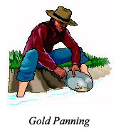
A simple gold pan is effective in detecting and
recovering gold from a streambed. Recreational gold panning is a
popular hobby in California and is enjoyed by California natives and visitors,
alike. If you want to find some gold and have fun doing it, gold panning will
suffice and will provide many happy hours of outdoor activity for you and your
family.
Inexpensive
light weight sluice boxes are often used in flowing streams to increase the
amount of material being washed for gold.
Metal detecting is done to
detect nuggets in streambeds, dry washes and arid areas. Dry washers are
also used to recover gold in the arid areas.
The great California Gold Rush in 1849 was of such importance, and has received so much publicity, that many people are not aware that the California Gold Rush was preceded by gold rushes in the Southeastern States. Nor are they aware that much gold mining was done to the south, in what is now Southern California, long before the discovery at Sutter's mill that set off the 1849 gold rush.
The first documented discovery of gold in the United States was in North Carolina in 1799 and gold mining started there in 1803. A major gold rush took place in Georgia in 1828 and a lesser rush occurred in Alabama in the 1830's. Most of the gold mining districts in the West were located by pioneers, many of whom were experienced gold miners from Alabama and Georgia.
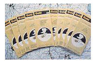
Gold mining, prospecting and panning locations in California extend from the Mexican border to the Oregon state line and eastward to the Arizona and Nevada state lines. Both Northern and Southern California provide ample prospecting and panning locations where you may find gold. Big Ten's six California Gold Prospecting and Panning Maps show locations where to hunt for gold in California.
Prior work by geologists of the U.S. Bureau of Mines, the U.S. Geological Survey and the California Division of Mines and Geology is acknowledged. Of special mention is the prior work of William B. Clark and Ralph Loyd of the California Division of Mines and Geology and that of Waldemar P. Lindgren of the U.S. Geological Survey. The excellent California Division of Mines and Geology Bulletin 193, by William B. Clark, was drawn upon for details of specific gold districts throughout the state and for text regarding the Klamath Mountains region of Northern California. Lindgren's work published in the year 1911 as regards the ancient Tertiary Rivers is considered a classic.
Knowledge of places where gold has been found in the past is useful in searching for more gold. A brief mention is made here of the overall scope of the California gold maps. For more details, please click on each map listed in the left column of this page. For your benefit, you will find there lists of towns near which gold deposits exist and a much expanded description.
|
 Gold Maps - Eastern States and California
CALIFORNIA GOLD PROSPECTING AND PANNING LOCATIONS
SET OF SIX CALIFORNIA GOLD MAPS
(MEXICO TO OREGON)
The
California gold mines and prospecting and panning
locations shown on maps 1 through 6 are continuous map-to-map from the
Mexican Border to the Oregon state line.
A good gift.
CALIFORNIA GOLD PROSPECTING MAP 1 - The
gold mining and prospecting sites of California Gold Region 1
are shown on California Gold Prospecting Map 1. You will see gold mines and
prospects in the mountains, valleys, dry washes and deserts.
California Gold Prospecting Map 1 shows 405 gold mines and
prospecting sites adjacent to Arizona & Nevada and from Mexico to Death Valley. Yuma,
the Colorado River, Picacho, Pot Holes, Glamis, Brawley, Salton Sea, Blythe
and Needles are shown. There are gold mining and prospecting sites in Imperial, Riverside, San Bernardino
and Kern counties. This famous
California gold mining region is of great interest to gold prospectors and treasure
hunters having metal detectors.
The gold mines and prospecting and panning sites continue to the west on
adjoining California Gold Prospecting Maps 2, 3, and 4.
CALIFORNIA GOLD PROSPECTING MAP 2 -
Three hundred forty (340) gold mines and prospecting and panning sites are seen in California Gold Region 2. San Diego, Escondido, Santa Ana, Riverside, Palm Springs, Indio, Julian, Banner, Dulzura, Jacumba,
and El Centro are shown. There are gold mines and prospecting and panning
sites in the mountains, streams and national forests. Excellent camping, fishing, hiking and recreational vehicle
facilities will be found in California Gold Region 2.
The gold mines and prospecting and panning sites continue on adjoining California Gold
Prospecting Maps 1 and 3.
CALIFORNIA GOLD PROSPECTING MAP 3 -
Five hundred thirteen (513) gold mines and prospecting and panning locations will be
seen on this
map of California Gold Region 3.
Los Angeles, Ventura, San Bernardino, Big Bear Lake, Lancaster, Palmdale, Barstow, Victorville,
and Twenty-Nine Palms are shown, There are gold mines and prospecting and
panning sites in
the San Gabriel, Tehachapi & San Bernardino Mountains and in the Angeles & San Bernardino National Forests. The Frazier Mountain and Piru Creek gold
deposits are also shown. There is good gold prospecting, gold panning, treasure hunting, rockhounding and metal
detecting throughout California Gold Region 3 and there are many gold mines and prospects
near Los Angeles and San
Bernardino.
The gold mines and prospecting and panning sites continue on adjoining California Gold
Prospecting Maps 1, 2 and 4.
 CALIFORNIA GOLD
PROSPECTING MAP 4 - California Gold Prospecting Map 4 shows
seven hundred seventy (770) gold mines and prospecting and panning
sites in California Gold Region 4. Many well-known gold mining towns, such as Randsburg, Johannesburg and
Trona are in this region. You will also see Mojave, China Lake, Bakersfield, Porterville
Fresno, Fort Irwin, the Sierra, Sequoia, & Inyo National Forests, the Kings, Kern & Owens rivers and the Slate, El Paso & Inyo Mountains. Treasure hunters with metal detectors like to "gold nugget shoot" in this famous gold
prospecting and mining region and prospectors like to pan for gold
in the streams.
CALIFORNIA GOLD
PROSPECTING MAP 4 - California Gold Prospecting Map 4 shows
seven hundred seventy (770) gold mines and prospecting and panning
sites in California Gold Region 4. Many well-known gold mining towns, such as Randsburg, Johannesburg and
Trona are in this region. You will also see Mojave, China Lake, Bakersfield, Porterville
Fresno, Fort Irwin, the Sierra, Sequoia, & Inyo National Forests, the Kings, Kern & Owens rivers and the Slate, El Paso & Inyo Mountains. Treasure hunters with metal detectors like to "gold nugget shoot" in this famous gold
prospecting and mining region and prospectors like to pan for gold
in the streams.
The gold mines and prospecting and panning sites continue on adjoining California Gold
Prospecting Maps 1, 3 and 5.
CALIFORNIA GOLD PROSPECTING MAP 5
-Three thousand (3,000) gold mines and prospecting and panning
locations are shown on this California Mother Lode Gold Map. California Gold
Region 5 extends northward from
about 40 miles south of Yosemite National Park to Quincy and Paradise and eastward from Sacramento to Lake Tahoe.
The cities of Jamestown, Columbia, Grass Valley, Downieville,
Merced, Mariposa and Marysville are
in this region, as are eight national forests. The "Ancient (Tertiary)
Rivers of Gold" are shown, plus the American, Calaveras, Cosumnes, Feather, Merced, Mokelumne, Sacramento, Stanislaus, Tuolumne and Yuba gold-bearing rivers. California
Gold Region 5 is a world-class gold prospecting and gold panning region. You
will enjoy visiting the old gold mining ghost towns and viewing the gold mining
artifacts on display. Gold panning is done throughout the area. California's "Ancient Rivers of
Gold" are shown. (Please see the "Ancient Rivers of Gold"
link in the left column.)
The gold mines and prospecting and panning sites continue on adjoining California Gold
Prospecting Maps 4 and 6.
CALIFORNIA GOLD
PROSPECTING MAP 6 -The
California gold mines and prospecting and panning locations in California Gold Region 6 extend from the north edge of
adjoining California Gold Prospecting Map 5 (latitude 40 Deg. N) to the Oregon state line. Superb scenery.
The Klamath, Trinity & Smith rivers and fifteen-hundred-eighty (1,580) gold mines and
prospecting and panning locations are shown, as well as the towns of Redding, Shasta, Susanville, Whiskeytown, French Gulch, Weed, Alturas, Orleans, Happy
Camp and Crescent City.
Gold mining production in California Gold Region 6 was second only to the
California Mother Lode. There are many gold prospecting, gold panning and gold mining locations here.
Gold deposits are shown on the Pacific coast beaches near Crescent
City on California Gold Prospecting Map 6.
The gold mines and prospecting and panning
sites continue to the south on adjoining California Gold
Prospecting Map 5 (Mother Lode).
POPULAR SETS OF CALIFORNIA GOLD MAPS
Popular sets,
which offer significant savings, are:
California Set (Maps 1 through 6), Southern California Set (Maps 1
through 4) and Northern California Set (Maps 5 and 6.) To
request these sets, and other sets offering savings, please go to REQUESTING GOLD MAPS
.
Copyright © 2015 H & H Engineering. All rights
reserved.